Project "Navigation anhand visueller Informationen zur erweiterten Wahrnehmung der Umgebung (NAVVIS)" (Mittelgeber: BMWi)


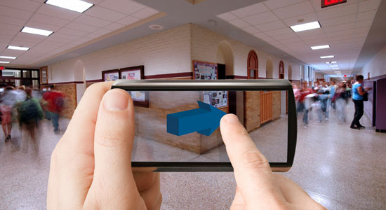
Using visual information carries a high potential for localization and map creation in unknown environments, which has barely been exploited so far. The project NAVVIS (Navigation anhand visueller Informationen zur erweiterten Wahrnehmung der Umgebung; translated: Navigation based on visual information for extended perception of the environment) aims at investigating and exploiting this potential by using visual sensors and by developing adequate methods and algorithms.
Localization and mapping of the environment are essential capabilities for determining a user's position and orientation. While self-localization is realized in many cases by satellite-based positioning, the exploration of unknown and indoor environments of larger buildings cannot be performed using satellite navigation. In the project NAVVIS, this gap is to be closed by using visual sensors.
A central challenge is the simultaneous localization and mapping in previously unknown environments, so that the location of an image can be determined without additional infrastructure and without a previously existing database. This can be achieved by combining relative position information and the ability to recognize formerly detected objects. Through the redundancy in the combined visual information, not only the position, but also the orientation can be determined, which is a basis for novel location-based services.
The methods and techniques to be developed in the project NAVVIS are thus a key technology enabling navigation and mapping without the need for a complex infrastructure. Besides the use in autonomous exploration of unknown environments, the techniques developed in NAVVIS have also a high potential to complement satellite-based navigation in the area of commercial mass market applications, like location-aware services.
In order to achieve these long-term goals, novel concepts and algorithms are to be developed. By reduction of complexity, they overcome the existing limitations regarding the extensiveness of the environment and the hardware requirements. Wide loops are to be closed very efficiently using content-based image retrieval approaches. These fundamental technologies are made usable for personal navigation by an interface that adapts to current context information.
Project Outline
| Project Title: | Navigation anhand visueller Informationen zur erweiterten Wahrnehmung der Umgebung (NAVVIS II) |
| Project Coordinator: | Eckehard Steinbach, Georg Schroth Lehrstuhl für Medientechnik Arcisstraße 21, 80333 München Tel.: 089-289-23500 |
| Project Runtime: | 01.04.2013 – 31.03.2015 |
| External Source: | BMWi |
| Cooperation Partners: | Lehrstuhl für Medientechnik |
| Homepage: | www.navvis.lmt.ei.tum.de |